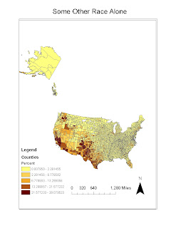
 According to the Some Other Race Alone map, we see that a majority of these people who identify themselves in this very broad category to live mostly on the west and southwest and northwest regions of the U.S. Since this is such a broad category it is difficult to determine the reasons why these people live in these regions.
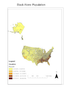
 According to the Black only population we see a majority of people who categorize themselves as being Black only have highest concentrations in the southern United States and lower regions of the east coast. Black history in the U.S. can explain why a majority of these people live mainly in these regions.
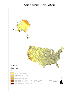
 According to the Asian only population we can see that most people who categorize themselves as Asian only live mainly on the west coast of the United States and Hawaii. This is mainly due to these locations being closer to Asian countries and historical movements in the U.S.
My concluding consensus of these maps is that given historical backgrounds of many different ethnic groups across the U.S. we can see many different spatial and locational patterns. Many of these groups try to settle in regions that have identical climate or ideal climate or social factors that explain why people live in certain regions. My overall interpretation of GIS is that it is a very intriguing field. With time and practice I believe I could use GIS for many more subjects and other purposes. It is fun program to use when you know what to do but when you get lost or mess something up, these small problems can make the assignments and other related work hard to fix.
No comments:
Post a Comment